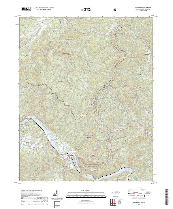
2022 Map of Hot Springs
USGS Topo · Published 2022About this map
The French Broad River carves a deep path through this landscape on the border of North Carolina and Tennessee, where the town of Hot Springs serves as a central hub. This modern survey illustrates the proximity of the Appalachian National Scenic Trail as it winds through the Pisgah National Forest and Cherokee National Forest. The map detail reveals significant local heritage markers, including the Odd Fellows Cem and several smaller family burial grounds like Lamb Cem and Haire Cem. These features, alongside named peaks like Rich Mtn and Spring Mtn, show a landscape defined by sharp elevation changes and narrow valleys. To the northwest, settlements like Houston Valley and Shaleville are linked by a network of forest roads and trails, such as the Jack Branch Trl, while the river's eastern banks contain the community of Runion and the crossing at Stackhouse.
Find a feature on this map
120 named features on this map. Tap any name to fly to it.
Don’t see what you’re looking for? This feature index may not catch every label — zoom into the map to look around manually.
Map Details
Editions of this 2022 Hot Springs Map
This is the sole edition of this map. No revisions or reprints were ever made.
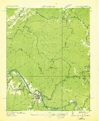
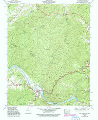
Historical Maps of Pine Spring Through Time
3 maps found