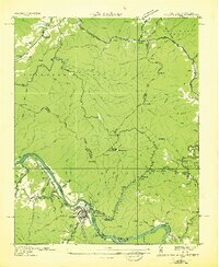
1935 Map of Hot Springs
USGS Topo · Published 1935About this map
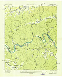
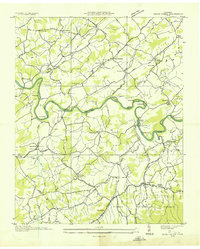
French Broad River corridors and the steep ridges of the Cherokee National Forest anchor this 1935 survey along the North Carolina and Tennessee border. The town of Hot Springs is the primary hub, showing the Southern Railway line following the river's bend past Mountain Island and the Deep Water Bridge. High in the surrounding mountains, the Appalachian Trail winds through gaps like Tanyard Gap and Deep Gap, while civil works like CCC Camp No F 7 and a Lookout Tower on Rich Mountain reflect the era's federal investment in the Appalachian landscape.
Find a feature on this map
90 named features on this map. Tap any name to fly to it.
Don’t see what you’re looking for? This feature index may not catch every label — zoom into the map to look around manually.
Map Details
Editions of this 1935 Hot Springs Map
This is the sole edition of this map. No revisions or reprints were ever made.
Other maps of this area

1892 · Greeneville
USGS Topo · 1:125,000

1894 · Asheville
USGS Topo · 1:125,000

1896 · Greeneville
USGS Topo · 1:125,000

1901 · Asheville
USGS Topo · 1:125,000

1904 · Greeneville
USGS Topo · 1:125,000
1935 · Paint Rock
USGS Topo · 1:24,000
1935 · Cedar Creek
USGS Topo · 1:24,000

1935 · Spring Creek
USGS Topo · 1:24,000

1935 · Lemon Gap
USGS Topo · 1:24,000
1936 · Marshall
USGS Topo · 1:24,000