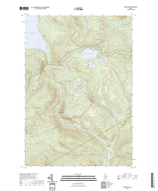
2024 Map of Houghton
USGS Topo · Published 2024About this map
Houghton and the surrounding mountain ridges of Franklin Co define this landscape of high peaks and secluded water bodies. The Appalachian National Scenic Trail traverses the northeastern high ground, passing near Sabbath Day Pond, Long Pond, and Round Pond beneath the heights of Four Ponds Mtn. In the west, the shoreline of Mooselookmeguntic Lake touches the settlement at Bemis, where Bemis Rd follows the contours of the land toward the interior.
Find a feature on this map
36 named features on this map. Tap any name to fly to it.
Don’t see what you’re looking for? This feature index may not catch every label — zoom into the map to look around manually.
Map Details
Editions of this 2024 Houghton Map
This is the sole edition of this map. No revisions or reprints were ever made.
Other maps of this area

1927 · Rumford
USGS Topo · 1:48,000

1930 · Rumford
USGS Topo · 1:62,500

1933 · Rangeley
USGS Topo · 1:48,000

1939 · Rangeley
USGS Topo · 1:62,500

1940 · Oquossoc
USGS Topo · 1:62,500

1942 · Oquossoc
USGS Topo · 1:62,500

1943 · Old Speck Mtn
USGS Topo · 1:62,500

1945 · Old Speck Mtn
USGS Topo · 1:62,500

1949 · Rangeley
USGS Topo · 1:62,500

1950 · Lewiston
USGS Topo · 1:250,000