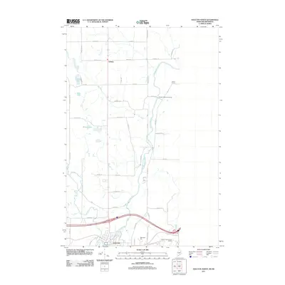
2011 Map of Houlton North
USGS Topo · Published 2011About this map
The Meduxnekeag River meanders northward from Houlton, anchoring a landscape defined by Aroostook County's agricultural traditions and its proximity to the New Brunswick border. Settlement is concentrated in the southern town of Houlton and the village of Littleton, with the rural crossing at Starkey Corners further north. This modern survey reflects the persistent grid of farm-to-market roads, such as Station Rd and Foxcroft Rd, which connect remote lake sites like Monson Lake and Carry Lake to the primary transportation corridors.
Find a feature on this map
51 named features on this map. Tap any name to fly to it.
Don’t see what you’re looking for? This feature index may not catch every label — zoom into the map to look around manually.
Map Details
Editions of this 2011 Houlton North Map
This is the sole edition of this map. No revisions or reprints were ever made.
Other maps of this area

1934 · Bridgewater
USGS Topo · 1:48,000

1938 · Bridgewater
USGS Topo · 1:62,500

1938 · Houlton
USGS Topo · 1:62,500

1951 · Houlton
USGS Topo · 1:62,500

1951 · Bridgewater
USGS Topo · 1:62,500

1953 · Bridgewater
USGS Topo · 1:50,000

1959 · Woodstock
USGS Topo · 1:250,000

1963 · Woodstock
USGS Topo · 1:250,000
1975 · Houlton SW
USGS Topo · 1:24,000
1975 · Houlton NW
USGS Topo · 1:24,000