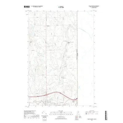
2018 Map of Houlton North
USGS Topo · Published 2018About this map
The Meduxnekeag River snakes through the heart of this Maine borderland, defining a landscape of agricultural plateaus and significant cemeteries. Settlement is concentrated around Littleton and the northern outskirts of Houlton, where the Houlton International Airport occupies the southeastern corner. Genealogists will find a high density of burial grounds, including the New Saint Marys Cem, Old Saint Marys Cem, and the historic Watson Settlement Cem.
Find a feature on this map
71 named features on this map. Tap any name to fly to it.
Don’t see what you’re looking for? This feature index may not catch every label — zoom into the map to look around manually.
Map Details
Editions of this 2018 Houlton North Map
This is the sole edition of this map. No revisions or reprints were ever made.
Other maps of this area

1934 · Bridgewater
USGS Topo · 1:48,000

1938 · Bridgewater
USGS Topo · 1:62,500

1938 · Houlton
USGS Topo · 1:62,500

1951 · Houlton
USGS Topo · 1:62,500

1951 · Bridgewater
USGS Topo · 1:62,500

1953 · Bridgewater
USGS Topo · 1:50,000

1959 · Woodstock
USGS Topo · 1:250,000

1963 · Woodstock
USGS Topo · 1:250,000
1975 · Houlton SW
USGS Topo · 1:24,000
1975 · Houlton NW
USGS Topo · 1:24,000