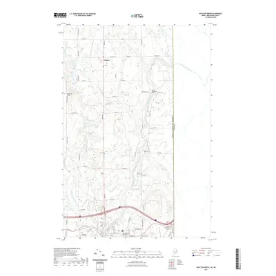
2021 Map of Houlton North
USGS Topo · Published 2021About this map
The Meduxnekeag River snakes through this Aroostook County landscape, crossing beneath the Watson Settlement Bridge as it flows toward the international boundary with Canada. This region, centered on the town of Littleton, is characterized by its agricultural heritage and numerous family-named landmarks. Genealogists will find a wealth of burial sites, from the Littleton Cem and Weed Cem in the north to the Soldiers Cem and Evergreen Cem near the southern border. The map documents the northern reaches of Houlton, where Garrison Hill overlooks the surrounding terrain near the Houlton International Airport. Religious life is anchored by Saint Mary of the Visitation Church, while the landscape is dotted with small bodies of water like Long Lake, Deep Lake, and Monson Lake. The local road network, including Station Rd and Military St, reflects the area's historical development as a border community and transportation corridor.
Find a feature on this map
51 named features on this map. Tap any name to fly to it.
Don’t see what you’re looking for? This feature index may not catch every label — zoom into the map to look around manually.
Map Details
Editions of this 2021 Houlton North Map
This is the sole edition of this map. No revisions or reprints were ever made.
Other maps of this area

1934 · Bridgewater
USGS Topo · 1:48,000

1938 · Bridgewater
USGS Topo · 1:62,500

1938 · Houlton
USGS Topo · 1:62,500

1951 · Houlton
USGS Topo · 1:62,500

1951 · Bridgewater
USGS Topo · 1:62,500

1953 · Bridgewater
USGS Topo · 1:50,000

1959 · Woodstock
USGS Topo · 1:250,000

1963 · Woodstock
USGS Topo · 1:250,000
1975 · Houlton SW
USGS Topo · 1:24,000
1975 · Houlton NW
USGS Topo · 1:24,000