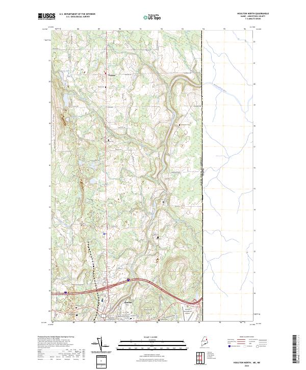
2024 Map of Houlton North
USGS Topo · Published 2024About this map
Littleton and the northern reaches of Houlton anchor this Aroostook County landscape, where the international boundary with Canada runs north-to-south along the eastern edge. The Meduxnekeag River snakes through the central terrain, fed by local waters such as Big Brook and Captain Ambrose Bear Stream. This map reveals a high density of genealogical sites, including the Evergreen Cem, New Saint Marys Cem, and Soldiers Cem near the town center. The presence of the Aroostook County Courthouse and Saint Mary of the Visitation Church highlights Houlton's role as a regional civic and religious hub. The surrounding countryside is defined by agricultural and timber tracts along Littleton Ridge, connected by a network of rural routes like Front Ridge Rd and North Rd.
Find a feature on this map
73 named features on this map. Tap any name to fly to it.
Don’t see what you’re looking for? This feature index may not catch every label — zoom into the map to look around manually.
Map Details
Editions of this 2024 Houlton North Map
This is the sole edition of this map. No revisions or reprints were ever made.
Other maps of this area

1934 · Bridgewater
USGS Topo · 1:48,000

1938 · Bridgewater
USGS Topo · 1:62,500

1938 · Houlton
USGS Topo · 1:62,500

1951 · Houlton
USGS Topo · 1:62,500

1951 · Bridgewater
USGS Topo · 1:62,500

1953 · Bridgewater
USGS Topo · 1:50,000

1959 · Woodstock
USGS Topo · 1:250,000

1963 · Woodstock
USGS Topo · 1:250,000
1975 · Houlton SW
USGS Topo · 1:24,000
1975 · Houlton NW
USGS Topo · 1:24,000