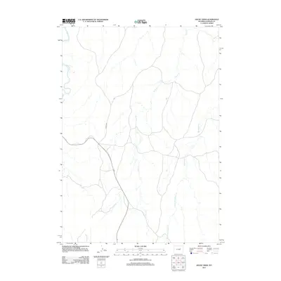
2012 Map of House Creek
USGS Topo · Published 2012About this map
The Powder River meanders through the northwest corner of this 2012 Johnson County survey, defining the landscape of this high plains region. This area of Wyoming is characterized by its drainage networks, where the Horse Cr and Bullwhacker Cr systems carve pathways through the open terrain. The presence of Streeter Rd and a network of unpaved routes suggests a landscape dedicated to ranching and resource management, with infrastructure primarily focused on connecting these remote reaches. To the south, the W Fork Bullwhacker Cr branches off, further illustrating the complex hydrology of the watershed. This digital-era map provides a clear view of the rural road patterns and water sources vital to the local ranching economy in the early 21st century.
Find a feature on this map
5 named features on this map. Tap any name to fly to it.
Don’t see what you’re looking for? This feature index may not catch every label — zoom into the map to look around manually.
Map Details
Editions of this 2012 House Creek Map
This is the sole edition of this map. No revisions or reprints were ever made.
Other maps of this area

1953 · Dry Fork Ranch
USGS Topo · 1:24,000

1953 · Fort Reno
USGS Topo · 1:24,000

1953 · Fort Reno SE
USGS Topo · 1:24,000

1954 · House Creek
USGS Topo · 1:24,000

1954 · Linch
USGS Topo · 1:24,000

1954 · Taylor Ranch
USGS Topo · 1:24,000

1955 · Arminto
USGS Topo · 1:250,000

1958 · Arminto
USGS Topo · 1:250,000

1961 · Soldier Creek
USGS Topo · 1:24,000

1961 · Dead Woman Crossing
USGS Topo · 1:24,000