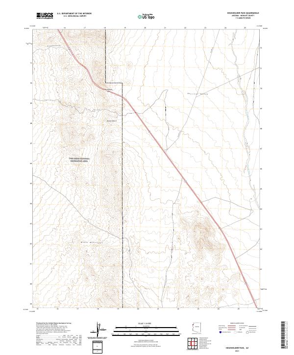
2021 Map of Housholder Pass
USGS Topo · Published 2021About this map
Housholder Pass serves as a critical geographic marker in this arid portion of Mohave County, where the road network transitions through the high ground between the Detrital Valley and the Mojave Desert. Much of the western half of this territory is managed as part of the Lake Mead National Recreation Area, a designation that preserves the stark landscape of the southern Black Mountains. The topographic detail reveals the complex drainage patterns of Detrital Wash, which collects runoff from the surrounding peaks. Transportation is defined by the corridors of Co Hwy 143 and the Willow Beach Access Rd, illustrating how infrastructure adheres to the natural contours of the basin and range province in northwestern Arizona.
Find a feature on this map
14 named features on this map. Tap any name to fly to it.
Don’t see what you’re looking for? This feature index may not catch every label — zoom into the map to look around manually.
Map Details
Editions of this 2021 Housholder Pass Map
This is the sole edition of this map. No revisions or reprints were ever made.
Other maps of this area

1886 · Camp Mohave
USGS Topo · 1:250,000

1892 · Camp Mohave
USGS Topo · 1:250,000

1926 · Nelson
USGS Topo · 1:96,000

1942 · Camp Mohave
USGS Topo · 1:250,000

1947 · Kingman
USGS Topo · 1:250,000

1948 · Kingman
USGS Topo · 1:250,000

1954 · Kingman
USGS Topo · 1:250,000

1955 · Kingman
USGS Topo · 1:250,000

1958 · Kingman
USGS Topo · 1:250,000
1959 · Willow Beach
USGS Topo · 1:24,000