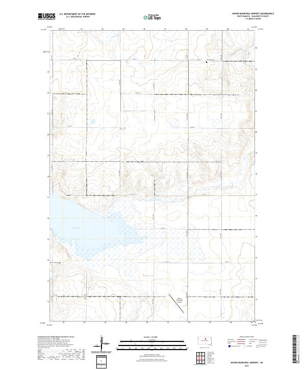
2021 Map of Hoven Municipal Airport
USGS Topo · Published 2021About this map
Swan Lake and its surrounding wetlands dominate the southern landscape of this Walworth County area, where the prairie begins to break into the subtle drainages of Swan Lake Cr. The land is organized by a rigid grid of rural routes, including 319th Ave and 140th St, reflecting the systematic agricultural development of the region. A notable point of local history is found at Theodore Cem in the northeastern section, a small landmark of early settlement preserved amidst the wide fields. The presence of the Hoven Municipal Airport near the center of the map indicates the modern infrastructure supporting this remote part of South Dakota, serving as a hub for local aviation and transit in an otherwise quiet, rural interior.
Find a feature on this map
20 named features on this map. Tap any name to fly to it.
Don’t see what you’re looking for? This feature index may not catch every label — zoom into the map to look around manually.
Map Details
Editions of this 2021 Hoven Municipal Airport Map
This is the sole edition of this map. No revisions or reprints were ever made.
Other maps of this area

1954 · Aberdeen
USGS Topo · 1:250,000

1956 · Aberdeen
USGS Topo · 1:250,000

1974 · Lowry
USGS Topo · 1:24,000

1974 · Hoven
USGS Topo · 1:24,000

1974 · Hoven Muni. Airport
USGS Topo · 1:24,000

1974 · Spring Lake
USGS Topo · 1:24,000
1974 · Lowry NW
USGS Topo · 1:24,000
1974 · Flight Lake
USGS Topo · 1:24,000

1974 · Bowdle
USGS Topo · 1:24,000

1978 · Seneca NW
USGS Topo · 1:24,000