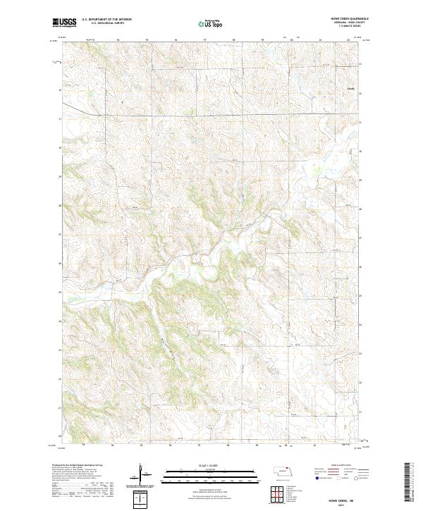
2021 Map of Howe Creek
USGS Topo · Published 2021About this map
Lindy serves as the primary point of settlement in this rural portion of Knox County, situated near the intersection of 891st Rd and 538 Ave. The landscape is defined by the drainage patterns of Howe Cr and its tributaries, which carve through the terrain to create a complex network of ridges and valleys. Evidence of the Public Land Survey System is prominent, with the map showing the junction of Townships 31 and 32 North across Ranges 4 and 5 West.
Find a feature on this map
22 named features on this map. Tap any name to fly to it.
Don’t see what you’re looking for? This feature index may not catch every label — zoom into the map to look around manually.
Map Details
Editions of this 2021 Howe Creek Map
This is the sole edition of this map. No revisions or reprints were ever made.
Other maps of this area

1955 · Sioux City
USGS Topo · 1:250,000

1958 · Sioux City
USGS Topo · 1:250,000

1959 · Sioux City
USGS Topo · 1:250,000

1974 · Sparta
USGS Topo · 1:24,000

1974 · Lindy
USGS Topo · 1:24,000
1974 · Center West
USGS Topo · 1:24,000

1974 · Bloomfield
USGS Topo · 1:24,000
1974 · Center East
USGS Topo · 1:24,000

1974 · Howe Creek
USGS Topo · 1:24,000

1974 · Bon Homme Colony
USGS Topo · 1:24,000