
1974 Map of Howe Creek
USGS Topo · Published 1979About this map
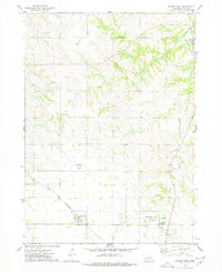
The Santee Indian Reservation encompasses this portion of Knox County, where the topography is defined by the winding course of Howe Creek. The landscape in the mid-1970s shows a rural environment with a small community presence centered near the Blessed Redeemer Ch. Drainage patterns are marked by Walker Draw and Hoboe Cr, with a specific Spring noted in the northeast, indicating the importance of local water sources in this upland terrain. Natural resource extraction is evident through several scattered Gravel Pit and Gravel Pits locations, which punctuate the sections. This survey provides a clear view of the rural road network and section lines as they existed before further modern development, preserving the placement of local landmarks and isolated industrial sites within the reservation boundaries.
Find a feature on this map
8 named features on this map. Tap any name to fly to it.
Don’t see what you’re looking for? This feature index may not catch every label — zoom into the map to look around manually.
Map Details
Editions of this 1974 Howe Creek Map
This is the sole edition of this map. No revisions or reprints were ever made.
Other maps of this area

1955 · Sioux City
USGS Topo · 1:250,000

1958 · Sioux City
USGS Topo · 1:250,000

1959 · Sioux City
USGS Topo · 1:250,000

1974 · Sparta
USGS Topo · 1:24,000

1974 · Lindy
USGS Topo · 1:24,000
1974 · Center West
USGS Topo · 1:24,000

1974 · Bloomfield
USGS Topo · 1:24,000
1974 · Center East
USGS Topo · 1:24,000

1974 · Bon Homme Colony
USGS Topo · 1:24,000
1977 · Center East
USGS Topo · 1:24,000