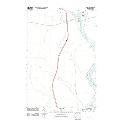
2011 Map of Howland
USGS Topo · Published 2011About this map
The confluence of the Piscataquis River and the Penobscot River defines the industrial and social heart of this Penobscot County region. In Howland, the landscape is shaped by water power and infrastructure, featuring the Howland Dam and the nearby Howland Post Office. Across the water, the settlement of West Enfield is anchored by the West Enfield Dam and the West Enfield Cemetery, illustrating a typical Maine river-town development pattern where industry and community are closely bound to the riverbanks.
Find a feature on this map
31 named features on this map. Tap any name to fly to it.
Don’t see what you’re looking for? This feature index may not catch every label — zoom into the map to look around manually.
Map Details
Editions of this 2011 Howland Map
This is the sole edition of this map. No revisions or reprints were ever made.
Other maps of this area

1917 · Passadumkeag
USGS Topo · 1:62,500

1933 · Boyd Lake
USGS Topo · 1:62,500

1942 · Lincoln
USGS Topo · 1:62,500

1947 · Schoodic
USGS Topo · 1:62,500

1949 · Schoodic
USGS Topo · 1:62,500

1951 · Boyd Lake
USGS Topo · 1:50,000

1954 · Millinocket
USGS Topo · 1:250,000

1955 · Boyd Lake
USGS Topo · 1:62,500

1957 · Lincoln
USGS Topo · 1:62,500

1958 · Millinocket
USGS Topo · 1:250,000