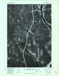
1975 Map of Howland
USGS Topo · Published 1981About this map
The confluence of the Piscataquis River and the Penobscot River serves as the focal point for this orthophotoquad, which captures the riverfront settlements of Howland and West Enfield during the mid-1970s. This aerial perspective reveals the sharp contrast between the established river towns and the expansive, drainage-heavy forest land to the west. The landscape is intricately carved by several watercourses including Meadow Brook, Pollard Brook, and Hoyt Brook, which reveal the wet, low-lying nature of the Penobscot County interior. The photographic imagery provides a clear view of the transportation corridors and industrial footprints along the riverbanks, illustrating the region's historical reliance on these major waterways for commerce and community development.
Find a feature on this map
7 named features on this map. Tap any name to fly to it.
Don’t see what you’re looking for? This feature index may not catch every label — zoom into the map to look around manually.
Map Details
Editions of this 1975 Howland Map
This is the sole edition of this map. No revisions or reprints were ever made.
Other maps of this area

1917 · Passadumkeag
USGS Topo · 1:62,500

1933 · Boyd Lake
USGS Topo · 1:62,500

1942 · Lincoln
USGS Topo · 1:62,500

1947 · Schoodic
USGS Topo · 1:62,500

1949 · Schoodic
USGS Topo · 1:62,500

1951 · Boyd Lake
USGS Topo · 1:50,000

1954 · Millinocket
USGS Topo · 1:250,000

1955 · Boyd Lake
USGS Topo · 1:62,500

1957 · Lincoln
USGS Topo · 1:62,500

1958 · Millinocket
USGS Topo · 1:250,000