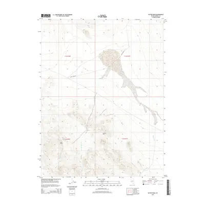
2014 Map of Hu-Pwi Wash
USGS Topo · Published 2014About this map
Greasewood Spring and the arid reaches of the Gillis Range define the western edge of this desert landscape in Mineral County. The terrain is shaped by an intricate network of seasonal drainage systems, most notably the wide alluvial fans of Hu-Pwi Wash, including its N Fork Hu-Pwi Wash and S Fork Hu-Pwi Wash. These channels converge and spread across the high basin floor, illustrating the flash-flood hydrology of the Great Basin. To the east, the Gumdrop Hills rise above the surrounding flats, while Hidden Wash carves its own path through the southeast corner. The only significant man-made infrastructure shown is Double Springs Rd, which cuts through the central valley, providing the primary access point for this isolated high-altitude environment.
Find a feature on this map
12 named features on this map. Tap any name to fly to it.
Don’t see what you’re looking for? This feature index may not catch every label — zoom into the map to look around manually.
Map Details
Editions of this 2014 Hu-Pwi Wash Map
This is the sole edition of this map. No revisions or reprints were ever made.
Other maps of this area

1908 · Carson Sink
USGS Topo · 1:250,000

1909 · Hawthorne
USGS Topo · 1:250,000

1910 · Carson Sink
USGS Topo · 1:250,000

1911 · Hawthorne
USGS Topo · 1:250,000

1915 · Hawthorne
USGS Topo · 1:250,000

1948 · Walker Lake
USGS Topo · 1:250,000

1951 · Allen Springs
USGS Topo · 1:62,500

1957 · Walker Lake
USGS Topo · 1:250,000

1957 · Reno
USGS Topo · 1:250,000

1959 · Reno
USGS Topo · 1:250,000