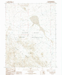
1987 Map of Hu-Pwi Wash
USGS Topo · Published 1988About this map
The Walker River Indian Reservation dominates the central landscape of this 1980s Mineral County survey, illustrating the intersection of protected lands and industrial history. The terrain is defined by the high elevations of the Gillis Range and the drainage systems of Hu-Pwi Wash and Hidden Wash. Evidence of early 20th-century transportation and resource extraction is clear through the prominent Old RR Grade cutting across the northern reaches and multiple mining sites. Prospectors and local historians can trace the locations of the Centipede Mine and the Red Granite Mine, alongside various unnamed prospect pits that pepper the hillsides. Significant natural landmarks like the expansive Dry Lake and the Pilot Cone Well indicate the arid character of this Basin and Range territory, where water sources and mineral deposits shaped human activity.
Find a feature on this map
13 named features on this map. Tap any name to fly to it.
Don’t see what you’re looking for? This feature index may not catch every label — zoom into the map to look around manually.
Map Details
Editions of this 1987 Hu-Pwi Wash Map
This is the sole edition of this map. No revisions or reprints were ever made.
Other maps of this area

1908 · Carson Sink
USGS Topo · 1:250,000

1909 · Hawthorne
USGS Topo · 1:250,000

1910 · Carson Sink
USGS Topo · 1:250,000

1911 · Hawthorne
USGS Topo · 1:250,000

1915 · Hawthorne
USGS Topo · 1:250,000

1948 · Walker Lake
USGS Topo · 1:250,000

1951 · Allen Springs
USGS Topo · 1:62,500

1957 · Walker Lake
USGS Topo · 1:250,000

1957 · Reno
USGS Topo · 1:250,000

1959 · Reno
USGS Topo · 1:250,000