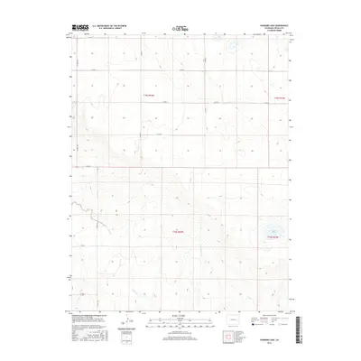
2016 Map of Hubbard Lake
USGS Topo · Published 2016About this map
Adobe Cr and the E Fork Adobe Cr define the drainage patterns across this high plains landscape in Lincoln County. The 2016 survey illustrates a strictly organized grid of sectional roads, including CO Rd T and CO Hwy 109, which reflect the enduring legacy of the Public Land Survey System in eastern Colorado. This agricultural and ranching territory is dotted with essential water resources like Redwood Tank and the map's namesake, Hubbard Lake, located in the southeastern quadrant. These features indicate the vital role of water management in a region where the topography is characterized by subtle elevation changes and expansive open range. The transition between t15s r54w and surrounding townships underscores the vast scale of land division used for contemporary ranching operations.
Find a feature on this map
18 named features on this map. Tap any name to fly to it.
Don’t see what you’re looking for? This feature index may not catch every label — zoom into the map to look around manually.
Map Details
Editions of this 2016 Hubbard Lake Map
This is the sole edition of this map. No revisions or reprints were ever made.
Other maps of this area

1889 · Sanborn
USGS Topo · 1:125,000

1891 · Sanborn
USGS Topo · 1:125,000

1891 · Arroyo
USGS Topo · 1:125,000

1893 · Arroyo
USGS Topo · 1:125,000

1893 · Sanborn
USGS Topo · 1:125,000

1954 · Lamar
USGS Topo · 1:250,000

1958 · Lamar
USGS Topo · 1:250,000

1975 · Stanley Gulch
USGS Topo · 1:24,000

1978 · Barrel Springs Draw
USGS Topo · 1:24,000
1978 · Metz Springs
USGS Topo · 1:24,000