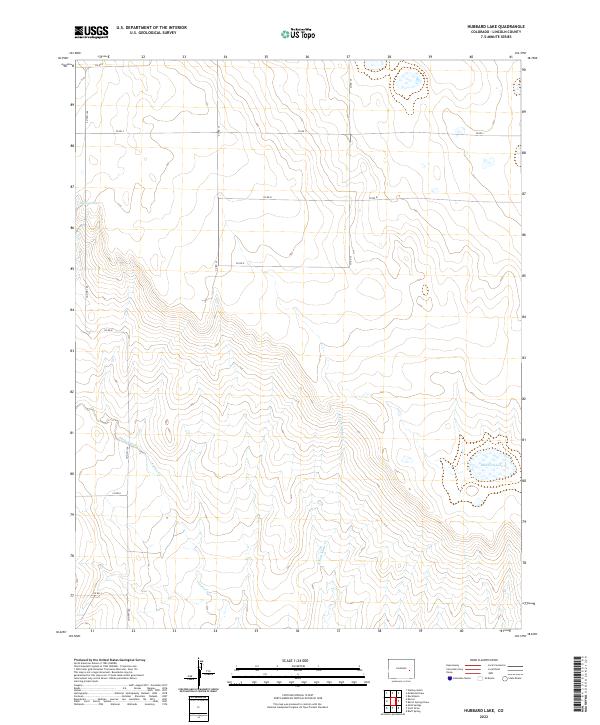
2022 Map of Hubbard Lake
USGS Topo · Published 2022About this map
Adobe Creek and its seasonal tributaries carve a winding path through this high plains section of Lincoln County. The landscape is defined by the drainage of the E Fork Adobe Cr and the presence of Hubbard Lake in the southeast. This map illustrates the intersection of rural infrastructure and water management, where isolated features like Redwood Tank serve as vital landmarks in an arid environment. The vast section lines of the Public Land Survey System, including t15s r54w and t16s r54w, organize the territory into a rigid grid. Transportation is primarily limited to a network of county roads such as Co Rd S and Co Rd R, which follow these section boundaries. The concentration of these routes, alongside Co Hwy 109, highlights the enduring reliance on a systematic road grid for navigating the expansive ranching or agricultural lands of eastern Colorado.
Find a feature on this map
20 named features on this map. Tap any name to fly to it.
Don’t see what you’re looking for? This feature index may not catch every label — zoom into the map to look around manually.
Map Details
Editions of this 2022 Hubbard Lake Map
This is the sole edition of this map. No revisions or reprints were ever made.
Other maps of this area

1889 · Sanborn
USGS Topo · 1:125,000

1891 · Sanborn
USGS Topo · 1:125,000

1891 · Arroyo
USGS Topo · 1:125,000

1893 · Arroyo
USGS Topo · 1:125,000

1893 · Sanborn
USGS Topo · 1:125,000

1954 · Lamar
USGS Topo · 1:250,000

1958 · Lamar
USGS Topo · 1:250,000

1975 · Stanley Gulch
USGS Topo · 1:24,000

1978 · Barrel Springs Draw
USGS Topo · 1:24,000
1978 · Metz Springs
USGS Topo · 1:24,000