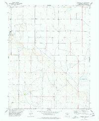
1978 Map of Hubbard Lake
USGS Topo · Published 1978About this map
Adobe Creek and its tributary, the East Fork Adobe Creek, dominate this high plains landscape of the Lincoln County panhandle in the late 1970s. The terrain is characterized by a network of drainage basins and intermittent water sources, such as Hubbard Lake and the water infrastructure of the Redwood Tank. While largely open range, the area includes a localized industry evidenced by a Gravel Pit and recreation at the Karval Lake State Rec Area in the northwest corner. This period of surveying captures the transition of the Colorado prairie, where section-line roads and scattered wells indicate the sparse but organized settlement pattern of ranching and early land management in eastern Colorado.
Find a feature on this map
9 named features on this map. Tap any name to fly to it.
Don’t see what you’re looking for? This feature index may not catch every label — zoom into the map to look around manually.
Map Details
Editions of this 1978 Hubbard Lake Map
This is the sole edition of this map. No revisions or reprints were ever made.
Other maps of this area

1889 · Sanborn
USGS Topo · 1:125,000

1891 · Sanborn
USGS Topo · 1:125,000

1891 · Arroyo
USGS Topo · 1:125,000

1893 · Arroyo
USGS Topo · 1:125,000

1893 · Sanborn
USGS Topo · 1:125,000

1954 · Lamar
USGS Topo · 1:250,000

1958 · Lamar
USGS Topo · 1:250,000

1975 · Stanley Gulch
USGS Topo · 1:24,000

1978 · Barrel Springs Draw
USGS Topo · 1:24,000
1978 · Metz Springs
USGS Topo · 1:24,000