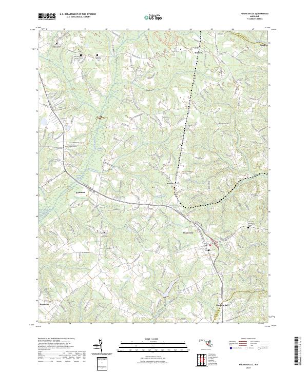
2023 Map of Hughesville
USGS Topo · Published 2023About this map
Hughesville and the surrounding Maryland countryside are defined by a complex network of wetlands and long-established parishes. The landscape is dominated by the sprawling Zekiah Swamp and its primary drainage, Zekiah Swamp Run, which are joined by smaller systems like Jordan Swamp and Mill Dam Run. This area preserves significant genealogical sites, particularly concentrated around Catholic and Quaker history, including the Saint Peter's Catholic Church/Cem and the Society of Friends Cem.
Find a feature on this map
193 named features on this map. Tap any name to fly to it.
Don’t see what you’re looking for? This feature index may not catch every label — zoom into the map to look around manually.
Map Details
Editions of this 2023 Hughesville Map
This is the sole edition of this map. No revisions or reprints were ever made.
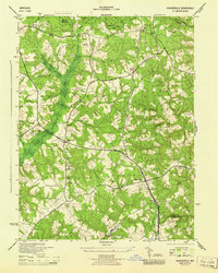
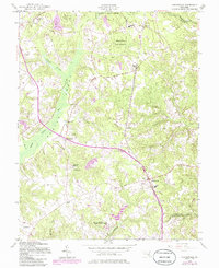
Historical Maps of Malcolm Through Time
3 maps found