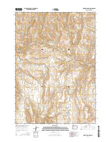
2014 Map of Hunter Mountain
USGS Topo · Published 2014About this map
Hunter Mountain and Bendire Mtn anchor this high-desert landscape in northern Malheur County, where complex drainage systems and isolated water sources define the geography. The map reveals an intricate network of named springs, including Schoolmarm Spring, Wilson Spring, and Kitten Canyon Spring, which are essential markers in this arid environment. Significant water management is evident through the presence of the Hunter Ditch and several catchments such as Kitten Canyon Reservoir and Mailbox Canyon Reservoir.
Find a feature on this map
48 named features on this map. Tap any name to fly to it.
Don’t see what you’re looking for? This feature index may not catch every label — zoom into the map to look around manually.
Map Details
Editions of this 2014 Hunter Mountain Map
This is the sole edition of this map. No revisions or reprints were ever made.
Other maps of this area

1908 · Ironside Mountain
USGS Topo · 1:125,000

1955 · Baker
USGS Topo · 1:250,000

1955 · Burns
USGS Topo · 1:250,000

1955 · Canyon City
USGS Topo · 1:250,000

1955 · Boise
USGS Topo · 1:250,000

1958 · Burns
USGS Topo · 1:250,000

1958 · Boise
USGS Topo · 1:250,000

1959 · Baker
USGS Topo · 1:250,000

1959 · Burns
USGS Topo · 1:250,000

1959 · Canyon City
USGS Topo · 1:250,000