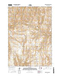
2017 Map of Hunter Mountain
USGS Topo · Published 2017About this map
Hunter Mountain and the surrounding high country of Malheur County define this landscape of canyons and vital water sources. The map reveals an intricate network of drainage systems and artificial water management features, including the Hunter Ditch and several highland catchments such as Big Flat Reservoir and Willow Basin Reservoir. Named for local landforms and early landmarks, the area is marked by distinctive geological features like Steamboat Rock and the broad expanse of Beaver Dam Flat. The naming conventions found here, such as Baker City Draw and Baker City Canyon, suggest the historical movement of people and livestock toward regional hubs. From the heights of Bendire Mountain to the depths of Kitten Canyon, the survey details a remote interior where springs like Kitten Canyon Spring and Wilson Spring remain essential markers of the terrain's utility.
Find a feature on this map
48 named features on this map. Tap any name to fly to it.
Don’t see what you’re looking for? This feature index may not catch every label — zoom into the map to look around manually.
Map Details
Editions of this 2017 Hunter Mountain Map
This is the sole edition of this map. No revisions or reprints were ever made.
Other maps of this area

1908 · Ironside Mountain
USGS Topo · 1:125,000

1955 · Baker
USGS Topo · 1:250,000

1955 · Burns
USGS Topo · 1:250,000

1955 · Canyon City
USGS Topo · 1:250,000

1955 · Boise
USGS Topo · 1:250,000

1958 · Burns
USGS Topo · 1:250,000

1958 · Boise
USGS Topo · 1:250,000

1959 · Baker
USGS Topo · 1:250,000

1959 · Burns
USGS Topo · 1:250,000

1959 · Canyon City
USGS Topo · 1:250,000