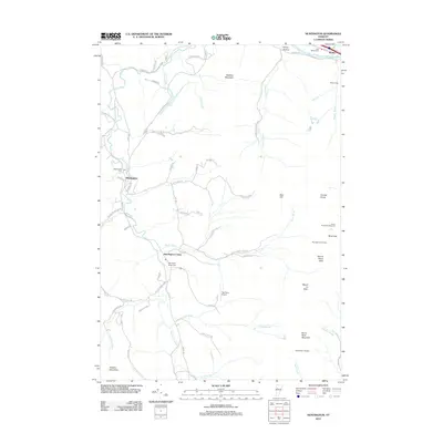
2012 Map of Huntington
USGS Topo · Published 2012About this map
Huntington River flows northward through the heart of this valley, serving as the geographic anchor for the settlements of Huntington and Huntington Center. The landscape is defined by the high peaks of the Green Mountains, including the iconic profile of Camels Hump and Mount Ethan Allen to the east, and Robbins Mountain and Browns Mountain to the west. Local genealogy is well-represented by several burial grounds, including Maplewood Cem and Huntington Center Cem. The northern boundary is marked by the Winooski River corridor at Bolton, where the rail line and Duxbury Rd parallel the water. Small mountain brooks like Brush Brook and Cobb Brook drain the steep hillsides, while the Teal Farm Airport and remote shelters such as Cowles Cove Shelter illustrate the mix of aviation history and recreational trail infrastructure in this high-elevation Vermont terrain.
Find a feature on this map
80 named features on this map. Tap any name to fly to it.
Don’t see what you’re looking for? This feature index may not catch every label — zoom into the map to look around manually.
Map Details
Editions of this 2012 Huntington Map
This is the sole edition of this map. No revisions or reprints were ever made.
Other maps of this area

1903 · Middlebury
USGS Topo · 1:62,500

1905 · Middlebury
USGS Topo · 1:62,500

1906 · Burlington
USGS Topo · 1:62,500

1919 · Burlington
USGS Topo · 1:62,500

1919 · Lincoln Mountain
USGS Topo · 1:62,500

1920 · Lincoln Mountain
USGS Topo · 1:48,000

1920 · Middlebury
USGS Topo · 1:62,500

1921 · Richmond
USGS Topo · 1:48,000

1921 · Lincoln Mountain
USGS Topo · 1:62,500

1924 · Camels Hump
USGS Topo · 1:62,500