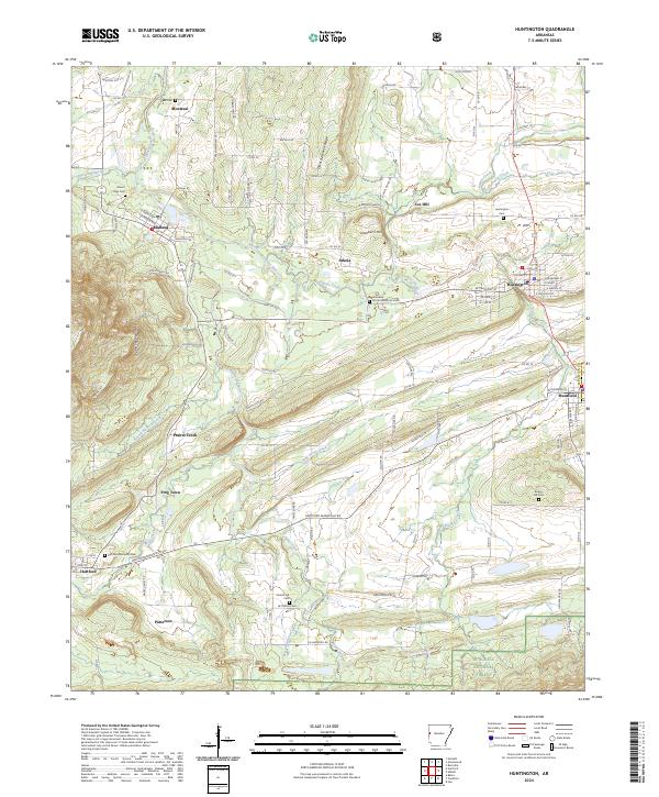
2024 Map of Huntington
USGS Topo · Published 2024About this map
Huntington and its surrounding coal-country settlements define this portion of Sebastian County along the western edge of Arkansas. The landscape is marked by the distinct northeasterly trend of Devils Backbone Ridge and the Sugar Loaf Mountains, which dictate the paths of waterways like the James Fork and Prairie Creek. Small communities such as Midland, Arkola, and Fox Hill are interconnected by a network of rural roads, while the southern reaches descend into the Ouachita National Forest. Genealogists and local historians will find several significant burial sites, including the Cherokee African American Cemetery near the center of the sheet. The proximity of settlements like Montreal, Frog Town, and Patterson suggests a dense history of residential and industrial development rooted in the region's geography.
Find a feature on this map
119 named features on this map. Tap any name to fly to it.
Don’t see what you’re looking for? This feature index may not catch every label — zoom into the map to look around manually.
Map Details
Editions of this 2024 Huntington Map
This is the sole edition of this map. No revisions or reprints were ever made.
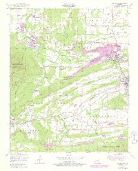
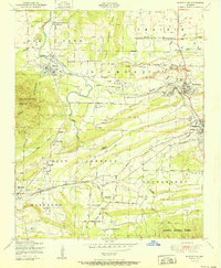
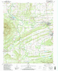
Historical Maps of Midland Through Time
4 maps found