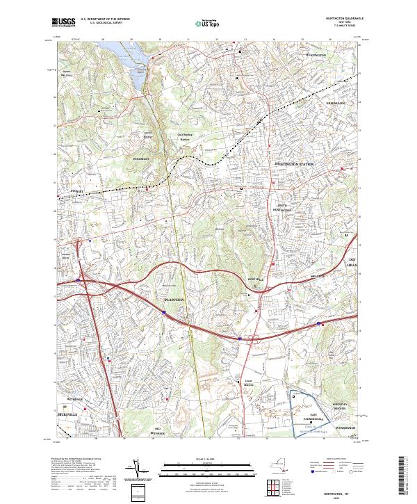
2023 Map of Huntington
USGS Topo · Published 2023About this map
The boundary between NASSAU CO and SUFFOLK CO splits this densely settled region of Long Island, where suburban growth and historic hamlets meet. Centered on the ridge lines of West Hills and Mannetto Hills, the landscape is defined by its deep roots, visible in the high concentration of burial grounds such as Old Burial Hill Cem and the vast Long Island National Cem. The map illustrates the development of residential corridors surrounding Huntington Station and Syosset, as well as the transition from the waterfront at Cold Spring Beach to the interior highlands of Half Hollow Hills. Large institutional tracts like Farmingdale State College stand out against the tight grid of modern suburban streets. This survey captures a moment where the mid-century industrial legacy of East Farmingdale sits alongside the older village character of Huntington and Cold Spring Harbor.
Find a feature on this map
48 named features on this map. Tap any name to fly to it.
Don’t see what you’re looking for? This feature index may not catch every label — zoom into the map to look around manually.
Map Details
Editions of this 2023 Huntington Map
This is the sole edition of this map. No revisions or reprints were ever made.
Other maps of this area

1897 · Hempstead
USGS Topo · 1:62,500

1897 · Oyster Bay
USGS Topo · 1:62,500

1898 · Hempstead
USGS Topo · 1:62,500

1898 · Oyster Bay
USGS Topo · 1:62,500

1899 · Hempstead
USGS Topo · 1:62,500

1900 · Oyster Bay
USGS Topo · 1:62,500

1901 · Babylon
USGS Topo · 1:62,500

1901 · Northport
USGS Topo · 1:62,500

1903 · Babylon
USGS Topo · 1:62,500

1903 · Northport
USGS Topo · 1:62,500