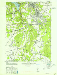
1947 Map of Huntington
USGS Topo · Published 1947About this map
Huntington and the surrounding north shore of Long Island are captured here just after the war, showcasing a landscape transitioning from grand estates to institutional and suburban development. The map details numerous private holdings such as the Chas L Tiffany Estate, the O H Kahn Estate, and the S L Robbins Jr Estate, while also highlighting significant community landmarks like the Nassau County Sanitarium and the New York Institute of Applied Agriculture.
Find a feature on this map
74 named features on this map. Tap any name to fly to it.
Don’t see what you’re looking for? This feature index may not catch every label — zoom into the map to look around manually.
Map Details
Editions of this 1947 Huntington Map
This is the sole edition of this map. No revisions or reprints were ever made.
Other maps of this area

1897 · Hempstead
USGS Topo · 1:62,500

1897 · Oyster Bay
USGS Topo · 1:62,500

1898 · Hempstead
USGS Topo · 1:62,500

1898 · Oyster Bay
USGS Topo · 1:62,500

1899 · Hempstead
USGS Topo · 1:62,500

1900 · Oyster Bay
USGS Topo · 1:62,500

1901 · Babylon
USGS Topo · 1:62,500

1901 · Northport
USGS Topo · 1:62,500

1903 · Babylon
USGS Topo · 1:62,500

1903 · Northport
USGS Topo · 1:62,500