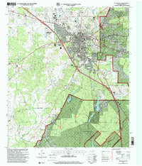
1997 Map of Huntsville
USGS Topo · Published 2000About this map
Academic and institutional development define Huntsville in the late 1990s, anchored by the expansive campus of Sam Houston State Teachers College. The landscape is notably marked by large state-operated landholdings, including the Wynne State Prison Farm to the northwest and the Goree State Prison Farm to the southeast, illustrating the unique intersection of civic life and correctional infrastructure in this part of Texas. These institutional grounds contrast with the dense woodlands of the Sam Houston National Forest that border the city.
Find a feature on this map
66 named features on this map. Tap any name to fly to it.
Don’t see what you’re looking for? This feature index may not catch every label — zoom into the map to look around manually.
Map Details
Editions of this 1997 Huntsville Map
This is the sole edition of this map. No revisions or reprints were ever made.
Other maps of this area

1954 · Beaumont
USGS Topo · 1:250,000

1957 · Beaumont
USGS Topo · 1:250,000

1959 · Moore Grove
USGS Topo · 1:24,000

1959 · San Jacinto
USGS Topo · 1:24,000

1960 · New Waverly
USGS Topo · 1:24,000

1960 · Phelps
USGS Topo · 1:24,000

1961 · Riverside
USGS Topo · 1:24,000

1962 · Pine Prairie
USGS Topo · 1:24,000

1962 · Galilee
USGS Topo · 1:24,000

1963 · Crabbs Prairie
USGS Topo · 1:24,000