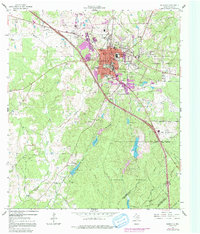
1963 Map of Huntsville
USGS Topo · Published 1991About this map
Huntsville serves as the institutional heart of Walker County in this mid-century survey, prominently featuring the sprawling campus of Sam Houston State Teachers College and the various facilities of the Texas Department of Corrections. The map reveals the extensive Wynne State Prison Farm and the main State Prison complex, emphasizing the town's long-standing role as a center for both education and the state's penal system. Residential growth is visible through the expansion of neighborhoods near Oakwood Cem and Samuel W Houston Sch.
Find a feature on this map
76 named features on this map. Tap any name to fly to it.
Don’t see what you’re looking for? This feature index may not catch every label — zoom into the map to look around manually.
Map Details
Editions of this 1963 Huntsville Map
4 editions found
Other maps of this area

1954 · Beaumont
USGS Topo · 1:250,000

1957 · Beaumont
USGS Topo · 1:250,000

1959 · Moore Grove
USGS Topo · 1:24,000

1959 · San Jacinto
USGS Topo · 1:24,000

1960 · New Waverly
USGS Topo · 1:24,000

1960 · Phelps
USGS Topo · 1:24,000

1961 · Riverside
USGS Topo · 1:24,000

1962 · Pine Prairie
USGS Topo · 1:24,000

1962 · Galilee
USGS Topo · 1:24,000

1963 · Crabbs Prairie
USGS Topo · 1:24,000