
1961 Map of Riverside
USGS Topo · Published 1962About this map
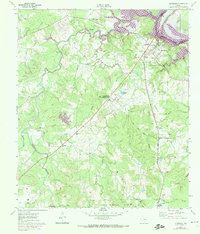
The Trinity River defines the northern boundary of this 1961 Texas landscape, where the Missouri Pacific railroad cuts a straight path through the dense timber of the Sam Houston National Forest. The map documents a significant educational landmark at the Sam Houston State Teachers College (Country Campus PO), positioned centrally among the rolling terrain and numerous creek systems. Settlement patterns are concentrated around small rural hubs like Riverside, Carolina, and Arizona, each supported by local institutions such as Arizona Jr High Sch and St Marys Ch.
Find a feature on this map
39 named features on this map. Tap any name to fly to it.
Don’t see what you’re looking for? This feature index may not catch every label — zoom into the map to look around manually.
Map Details
Editions of this 1961 Riverside Map
3 editions found
Other maps of this area

1954 · Beaumont
USGS Topo · 1:250,000

1957 · Beaumont
USGS Topo · 1:250,000

1960 · Trinity West
USGS Topo · 1:24,000

1960 · Trinity East
USGS Topo · 1:24,000

1960 · Phelps
USGS Topo · 1:24,000

1961 · Staley
USGS Topo · 1:24,000

1961 · Oakhurst
USGS Topo · 1:24,000

1962 · Pine Prairie
USGS Topo · 1:24,000

1962 · Wyser Bottom
USGS Topo · 1:24,000
1963 · Huntsville
USGS Topo · 1:24,000