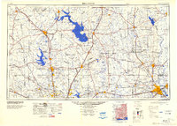
1954 Map of Beaumont
USGS Topo · Published 1964About this map
Sam Houston National Forest and the dense pine woods of the Big Thicket dominate this mid-century portrait of Southeast Texas. The map illustrates a landscape transitioning from heavy timber production to a sprawling petroleum economy, evidenced by a dense network of drilling operations such as the Saratoga Oil Field, Batson Oil Field, and the Hull Oil Field. To the east, the Neches River feeds into the Dam B Reservoir, a critical water management feature of the era. The industrial and transit hub of Beaumont anchors the southeast corner, connected by major rail lines including the Southern Pacific and Santa Fe. This survey also documents institutional land use, showing the expansive Eastham State Prison Farm and Wynne State Prison Farm in the northwest, alongside the campus of Prairie View College.
Find a feature on this map
166 named features on this map. Tap any name to fly to it.
Don’t see what you’re looking for? This feature index may not catch every label — zoom into the map to look around manually.
Map Details
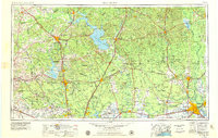
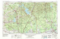
Editions of this 1954 Beaumont Map
3 editions found
Historical Maps of Houston Through Time
5 maps found