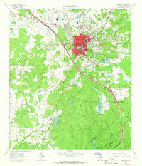
1963 Map of Huntsville
USGS Topo · Published 1966About this map
Sam Houston State Teachers College serves as the academic anchor for this East Texas community, shown here during the early 1960s. The landscape is defined by its institutional and natural boundaries, from the expansive Sam Houston National Forest to the specialized facilities of the Wynne State Prison Farm and Goree State Prison Farm. These state-managed lands create a distinct patchwork of forest and agricultural fields that surround the urban core of Huntsville.
Find a feature on this map
67 named features on this map. Tap any name to fly to it.
Don’t see what you’re looking for? This feature index may not catch every label — zoom into the map to look around manually.
Map Details
Editions of this 1963 Huntsville Map
4 editions found
Other maps of this area

1954 · Beaumont
USGS Topo · 1:250,000

1957 · Beaumont
USGS Topo · 1:250,000

1959 · Moore Grove
USGS Topo · 1:24,000

1959 · San Jacinto
USGS Topo · 1:24,000

1960 · New Waverly
USGS Topo · 1:24,000

1960 · Phelps
USGS Topo · 1:24,000

1961 · Riverside
USGS Topo · 1:24,000

1962 · Pine Prairie
USGS Topo · 1:24,000

1962 · Galilee
USGS Topo · 1:24,000

1963 · Crabbs Prairie
USGS Topo · 1:24,000