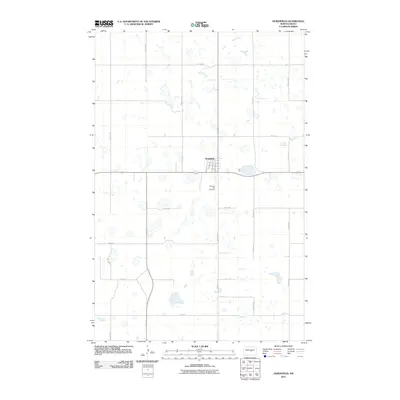
2011 Map of Hurdsfield
USGS Topo · Published 2011About this map
Hurdsfield serves as the central hub of this Wells County landscape, situated amidst the numerous prairie potholes and wetlands that characterize this portion of North Dakota. The town's grid is clearly defined by several named residential streets, including Myrtle Ave, Toms Ave, and Boody Ave, while Main St anchors the local commerce. The surrounding rural section lines are marked by a regular network of roads such as 29th Ave NE and 1st St NE, showing the enduring influence of the Public Land Survey System on the modern geography. Just south of the town center lies the Pleasant Hill Cemetery, a key site for local genealogical research. To the north, the headwaters of the James River meander through the terrain, illustrating the natural drainage patterns of this high plains region.
Find a feature on this map
24 named features on this map. Tap any name to fly to it.
Don’t see what you’re looking for? This feature index may not catch every label — zoom into the map to look around manually.
Map Details
Editions of this 2011 Hurdsfield Map
This is the sole edition of this map. No revisions or reprints were ever made.
Other maps of this area

1945 · Manfred
USGS Topo · 1:62,500

1946 · Sheyenne Lake
USGS Topo · 1:48,000

1947 · Sheyenne Lake
USGS Topo · 1:62,500

1948 · Manfred
USGS Topo · 1:62,500

1949 · Manfred SW
USGS Topo · 1:24,000

1950 · Manfred SE
USGS Topo · 1:24,000

1950 · Manfred SW
USGS Topo · 1:24,000

1952 · New Rockford
USGS Topo · 1:250,000

1954 · McClusky
USGS Topo · 1:250,000

1956 · New Rockford
USGS Topo · 1:250,000