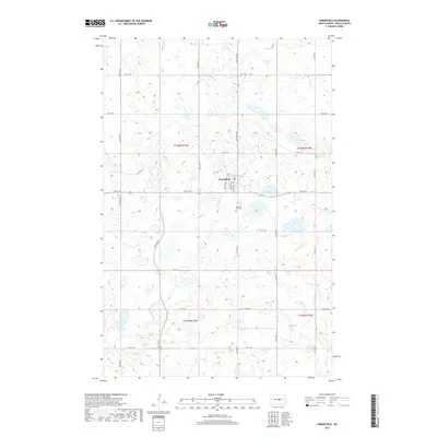
2017 Map of Hurdsfield
USGS Topo · Published 2017About this map
Hurdsfield serves as the central hub for this portion of Wells County, situated atop a glaciated landscape characterized by numerous small wetlands and basins. The town's grid is anchored by Main St and a network of residential avenues including Myrtle Ave, Boody Ave, and Miller Ave. To the south of the main settlement lies the Pleasant Hill Cem, providing a focal point for local genealogical interest. The northern reaches of the map are defined by the winding course of the James River, which meanders through the prairie. This 2017 survey illustrates the persistent rural infrastructure of the North Dakota plains, where the rectilinear road system, including routes like 29th Ave NE and 2nd St NE, dictates the movement across a terrain dotted with countless seasonal ponds and permanent water bodies.
Find a feature on this map
29 named features on this map. Tap any name to fly to it.
Don’t see what you’re looking for? This feature index may not catch every label — zoom into the map to look around manually.
Map Details
Editions of this 2017 Hurdsfield Map
This is the sole edition of this map. No revisions or reprints were ever made.
Other maps of this area

1945 · Manfred
USGS Topo · 1:62,500

1946 · Sheyenne Lake
USGS Topo · 1:48,000

1947 · Sheyenne Lake
USGS Topo · 1:62,500

1948 · Manfred
USGS Topo · 1:62,500

1949 · Manfred SW
USGS Topo · 1:24,000

1950 · Manfred SE
USGS Topo · 1:24,000

1950 · Manfred SW
USGS Topo · 1:24,000

1952 · New Rockford
USGS Topo · 1:250,000

1954 · McClusky
USGS Topo · 1:250,000

1956 · New Rockford
USGS Topo · 1:250,000