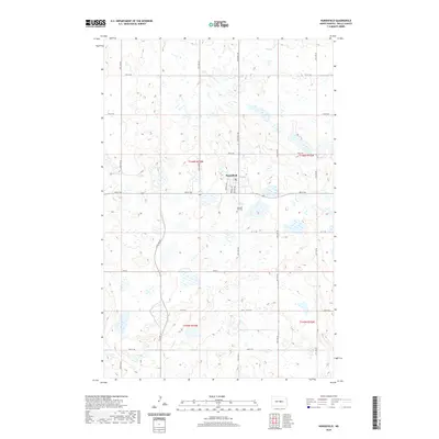
2020 Map of Hurdsfield
USGS Topo · Published 2020About this map
Hurdsfield serves as the central hub of this Wells County landscape, where the grid of the town site meets the sprawling prairie wetlands of central North Dakota. The settlement is defined by a traditional street plan including Main St, Myrtle Ave, and Boody Ave, situated just north of the Pleasant Hill rise. This high point is home to the Pleasant Hill Cem, a significant site for local genealogical research. To the north, the headwaters of the James River meander through the terrain, cutting across the sections of the Public Land Survey System. The map illustrates a classic Great Plains agricultural pattern, where section-line roads like 5th St NE and 26th Ave NE create a rigid geometry over a naturally undulating landscape of small lakes and seasonal ponds.
Find a feature on this map
29 named features on this map. Tap any name to fly to it.
Don’t see what you’re looking for? This feature index may not catch every label — zoom into the map to look around manually.
Map Details
Editions of this 2020 Hurdsfield Map
This is the sole edition of this map. No revisions or reprints were ever made.
Other maps of this area

1945 · Manfred
USGS Topo · 1:62,500

1946 · Sheyenne Lake
USGS Topo · 1:48,000

1947 · Sheyenne Lake
USGS Topo · 1:62,500

1948 · Manfred
USGS Topo · 1:62,500

1949 · Manfred SW
USGS Topo · 1:24,000

1950 · Manfred SE
USGS Topo · 1:24,000

1950 · Manfred SW
USGS Topo · 1:24,000

1952 · New Rockford
USGS Topo · 1:250,000

1954 · McClusky
USGS Topo · 1:250,000

1956 · New Rockford
USGS Topo · 1:250,000