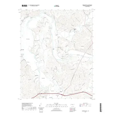
2019 Map of Hurricane Mills
USGS Topo · Published 2019About this map
Hurricane Mills serves as a central landmark in this portion of Humphreys County, situated where Hurricane Creek flows toward the Duck River. The landscape is defined by the winding paths of the Duck and Buffalo River, which carve through numerous named bottoms and hollows such as Cherry Bottom, Squeeze Bottom, and Voorhies Hollow. Small settlements and family clusters like Cedar Grove, Bakerville, and Caigletown are connected by a network of local routes, including Old State Hwy 13. The area is notably dense with small family burial grounds, including the O'Donnilley Cem, Shannon Cem, and Wright Cem, which offer significant value for genealogical research. River features like The Whirl and Whirl Bar indicate the complex hydrology that influenced early settlement and transport patterns in this Tennessee river valley.
Find a feature on this map
122 named features on this map. Tap any name to fly to it.
Don’t see what you’re looking for? This feature index may not catch every label — zoom into the map to look around manually.
Map Details
Editions of this 2019 Hurricane Mills Map
This is the sole edition of this map. No revisions or reprints were ever made.
Other maps of this area

1936 · Gorman
USGS Topo · 1:24,000

1936 · Hurricane Mills
USGS Topo · 1:24,000

1936 · Coble
USGS Topo · 1:24,000

1936 · Daniels Landing
USGS Topo · 1:24,000

1936 · Bucksnort
USGS Topo · 1:24,000

1936 · Johnsonville
USGS Topo · 1:24,000

1936 · Lobelville
USGS Topo · 1:24,000

1936 · Waverly
USGS Topo · 1:24,000

1936 · Hustburg
USGS Topo · 1:24,000

1949 · Daniels Landing
USGS Topo · 1:24,000