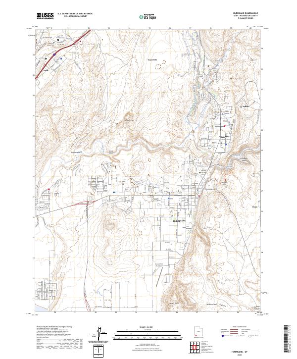
2023 Map of Hurricane
USGS Topo · Published 2023About this map
Hurricane and the surrounding Washington County landscape are defined by the dramatic ascent of the Hurricane Cliffs and the course of the Virgin River. The area shows a transition from the agricultural and residential patterns of La Verkin and Toquerville to the high desert terrain of the Uinkaret Plateau. Evidence of the region’s complex mining and religious history is preserved in localized sites such as the Silver Reef Protestant Cem and Silver Reef Catholic Cem near Leeds, reflecting the distinct social divisions of earlier eras.
Find a feature on this map
144 named features on this map. Tap any name to fly to it.
Don’t see what you’re looking for? This feature index may not catch every label — zoom into the map to look around manually.
Map Details
Editions of this 2023 Hurricane Map
This is the sole edition of this map. No revisions or reprints were ever made.
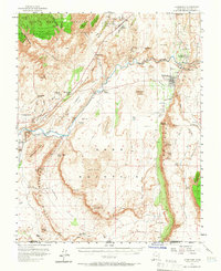
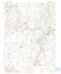
Historical Maps of Toquerville Through Time
3 maps found