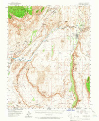
1954 Map of Hurricane
USGS Topo · Published 1965About this map
Hurricane and La Verkin stand as the primary centers of life along the Virgin River in this mid-century survey of southwestern Utah. The landscape is defined by its water sources and geologic formations, where the Hurricane Cliffs create a dramatic vertical boundary east of town. Agricultural and industrial activity is evident in the network of ditches, such as the Harrisburg Ditch, and specialized sites like the Cinder Pits and various quarries.
Find a feature on this map
62 named features on this map. Tap any name to fly to it.
Don’t see what you’re looking for? This feature index may not catch every label — zoom into the map to look around manually.
Map Details
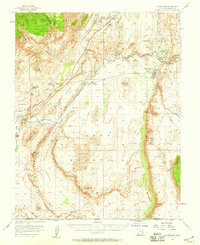
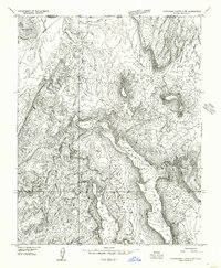
Editions of this 1954 Hurricane Map
2 editions found
Other maps of this area

1885 · St. George
USGS Topo · 1:250,000

1886 · Mt. Trumbull
USGS Topo · 1:250,000

1891 · St. George
USGS Topo · 1:250,000

1892 · Mt. Trumbull
USGS Topo · 1:250,000

1953 · Cedar City
USGS Topo · 1:250,000

1953 · Grand Canyon
USGS Topo · 1:250,000

1954 · La Verkin 4 NW
USGS Topo · 1:24,000

1954 · La Verkin 4 SW
USGS Topo · 1:24,000
1954 · Hurricane Cliffs 2 NW
USGS Topo · 1:24,000

1954 · La Verkin 3 NW
USGS Topo · 1:24,000