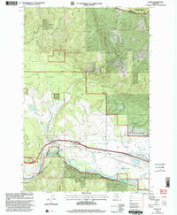
1999 Map of Huson
USGS Topo · Published 2003About this map
Huson sits at a critical transition point where the valley floor meets the high timberlands of the Lolo National Forest. The landscape is dominated by the wide corridor of the Clark Fork, which is paralleled by historical transit routes like the Mullan Road and the Southside Road. This 1999 revision captures the intersection of heavy resource management and recreational growth, visible in the numerous Gravel Pits and the established Frenchtown Pond State Park.
Find a feature on this map
21 named features on this map. Tap any name to fly to it.
Don’t see what you’re looking for? This feature index may not catch every label — zoom into the map to look around manually.
Map Details
Editions of this 1999 Huson Map
This is the sole edition of this map. No revisions or reprints were ever made.
Other maps of this area

1912 · Missoula
USGS Topo · 1:125,000

1956 · Wallace
USGS Topo · 1:250,000

1956 · Hamilton
USGS Topo · 1:250,000

1959 · Hamilton
USGS Topo · 1:250,000

1959 · Alberton
USGS Topo · 1:62,500

1959 · Arlee
USGS Topo · 1:62,500

1960 · Wallace
USGS Topo · 1:250,000

1960 · Hamilton
USGS Topo · 1:250,000

1963 · Primrose
USGS Topo · 1:24,000

1964 · Hamilton
USGS Topo · 1:250,000