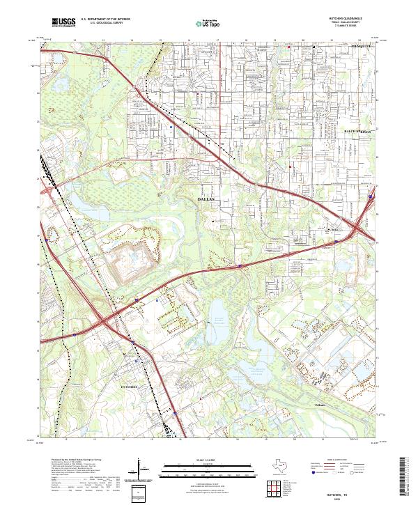
2022 Map of Hutchins
USGS Topo · Published 2022About this map
The Trinity River bottomlands dominate this landscape southeast of Dallas, where the river's winding course is flanked by a dense network of private clubs and water bodies. Local sportsmen and conservationists will recognize the expansive Fin and Feather Club Lake, Lancaster Club Lake, and the Dallas Hunting and Fishing Club Lake, which occupy the low-lying terrain north of Wilmer. These wetlands and sloughs, including Gravel Slough and Mooreland Lake, represent the natural floodplain buffer between the urban growth of Mesquite and the industrial corridors of the south.
Find a feature on this map
44 named features on this map. Tap any name to fly to it.
Don’t see what you’re looking for? This feature index may not catch every label — zoom into the map to look around manually.
Map Details
Editions of this 2022 Hutchins Map
This is the sole edition of this map. No revisions or reprints were ever made.
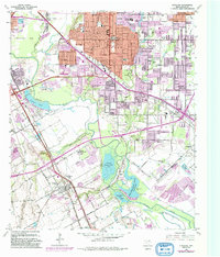
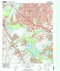
Historical Maps of Dallas Through Time
3 maps found