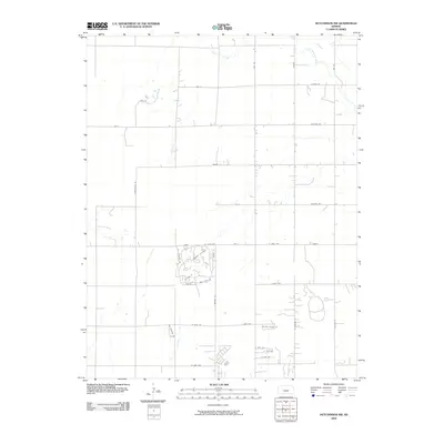
2009 Map of Hutchinson NW
USGS Topo · Published 2009About this map
Little Arkansas River meanders through the northeast corner of this Reno County landscape, while Sand Creek cuts across the northern section. The area shows a distinct transition from a rigid agricultural grid to specialized residential development, particularly evident in the winding street layouts of the south-central portion. Named roads like Country Club Dr, Putters Pt, and St Andrews Dr indicate a suburban community designed around leisure and recreational spaces. This 2009 survey by the U.S. Geological Survey captures the modern expansion north and west of the city center, where traditional section lines like Pennington Rd and Ave U meet newer cul-de-sacs and developments such as Rolling Dunes Rd.
Find a feature on this map
34 named features on this map. Tap any name to fly to it.
Don’t see what you’re looking for? This feature index may not catch every label — zoom into the map to look around manually.
Map Details
Editions of this 2009 Hutchinson NW Map
This is the sole edition of this map. No revisions or reprints were ever made.
Other maps of this area

1891 · Hutchinson
USGS Topo · 1:125,000

1893 · Hutchinson
USGS Topo · 1:125,000

1894 · Lyons
USGS Topo · 1:125,000

1955 · Great Bend
USGS Topo · 1:250,000

1955 · Hutchinson
USGS Topo · 1:250,000

1957 · Great Bend
USGS Topo · 1:250,000

1958 · Great Bend
USGS Topo · 1:250,000

1959 · Hutchinson
USGS Topo · 1:250,000

1960 · Yaggy
USGS Topo · 1:24,000
1960 · Hutchinson
USGS Topo · 1:24,000