
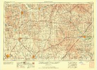
1959 Map of Hutchinson
USGS Topo · Published 1959About this map
The Flint Hills and Smoky Hills dominate the geography of central Kansas in this mid-century survey, illustrating the convergence of major rail networks and military aviation. Strategic hubs like Salina, Hutchinson, and Emporia serve as anchors for a landscape defined by the Arkansas River and Smoky Hill River valleys. The presence of Smoky Hill Air Force Base and specialized training areas like the Camp Phillips Air to Ground Gunnery Range reflects the region's importance to national defense during the Cold War era.
Find a feature on this map
164 named features on this map. Tap any name to fly to it.
Don’t see what you’re looking for? This feature index may not catch every label — zoom into the map to look around manually.
Map Details
Editions of this 1959 Hutchinson Map
2 editions found
Other maps of this area

1885 · Eskridge
USGS Topo · 1:125,000

1885 · Burlington
USGS Topo · 1:125,000

1885 · Eureka
USGS Topo · 1:125,000

1886 · Fredonia
USGS Topo · 1:125,000

1886 · Junction City
USGS Topo · 1:125,000

1888 · Emporia
USGS Topo · 1:125,000

1888 · Eureka
USGS Topo · 1:125,000

1888 · Eldorado
USGS Topo · 1:125,000

1889 · Burlingame
USGS Topo · 1:125,000

1889 · Newton
USGS Topo · 1:125,000