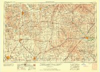
1959 Map of Hutchinson
USGS Topo · Published 1959About this map
Fort Riley and the sprawling military landscape of Central Kansas define this mid-century survey, which documents a complex network of agriculture and rail transport. The confluence of the Smoky Hill River and Saline River near Salina serves as a major hub for the Union Pacific RR and Santa Fe RR, while smaller agricultural centers like Lindsborg and Hillsboro anchor the surrounding farm country. The topography transitions from the plains into the distinctive Flint Hills, with water management clearly visible through features such as the Kanopolis Reservoir and Council Grove Lake. Transportation is dominated by major thoroughfares like Us 40 and Us 50, which connect established communities like Hutchinson and McPherson. This document provides a look at the region's infrastructure just as the interstate era was beginning to reshape the Kansas prairie, preserving the location of dozens of smaller sidings and rail stops along the Rock Island RR and Missouri Pacific RR.
Find a feature on this map
239 named features on this map. Tap any name to fly to it.
Don’t see what you’re looking for? This feature index may not catch every label — zoom into the map to look around manually.
Map Details
Editions of this 1959 Hutchinson Map
2 editions found

Other maps of this area

1885 · Eskridge
USGS Topo · 1:125,000

1885 · Burlington
USGS Topo · 1:125,000

1885 · Eureka
USGS Topo · 1:125,000

1886 · Fredonia
USGS Topo · 1:125,000

1886 · Junction City
USGS Topo · 1:125,000

1888 · Emporia
USGS Topo · 1:125,000

1888 · Eureka
USGS Topo · 1:125,000

1888 · Eldorado
USGS Topo · 1:125,000

1889 · Burlingame
USGS Topo · 1:125,000

1889 · Newton
USGS Topo · 1:125,000