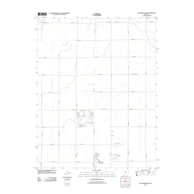
2012 Map of Hutchinson NW
USGS Topo · Published 2012About this map
The Little Arkansas River meanders across the northeast corner of this Reno County landscape, providing a natural contrast to the rigid section-line grid that defines the surrounding prairie. In the early 21st century, residential development began to reshape the area south of W 108th Ave, where a cluster of winding streets breaks from the standard orthographic pattern. This area includes named ways such as Paganica Pass, Crazy Horse Rd, and Dull Knife Rd, signaling a transition from traditional agriculture to suburban expansion. Infrastructure for these new communities is noted by the Reno County Blue Spruce Sewer District Number 3. Elsewhere, the drainage of Sand Cr and a series of rural avenues like Cheyenne Rd and Arapaho Rd illustrate the enduring agricultural character of the Kansas plains.
Find a feature on this map
52 named features on this map. Tap any name to fly to it.
Don’t see what you’re looking for? This feature index may not catch every label — zoom into the map to look around manually.
Map Details
Editions of this 2012 Hutchinson NW Map
This is the sole edition of this map. No revisions or reprints were ever made.
Other maps of this area

1891 · Hutchinson
USGS Topo · 1:125,000

1893 · Hutchinson
USGS Topo · 1:125,000

1894 · Lyons
USGS Topo · 1:125,000

1955 · Great Bend
USGS Topo · 1:250,000

1955 · Hutchinson
USGS Topo · 1:250,000

1957 · Great Bend
USGS Topo · 1:250,000

1958 · Great Bend
USGS Topo · 1:250,000

1959 · Hutchinson
USGS Topo · 1:250,000

1960 · Yaggy
USGS Topo · 1:24,000
1960 · Hutchinson
USGS Topo · 1:24,000