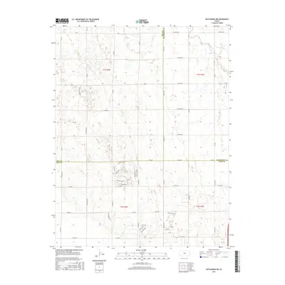
2015 Map of Hutchinson NW
USGS Topo · Published 2015About this map
The Little Arkansas River winds through the northeast corner of this central Kansas landscape, a region defined by its intersection of three counties and a meticulously planned grid of rural roads. At the convergence of Rice, McPherson, and Reno Counties, the area showcases a transition from traditional section-line farming plots to more modern residential developments. In the southern portion of the quadrangle, a distinct neighborhood character emerges near Paganica Pass, where street names like Dull Knife Rd, Crazy Horse Rd, and W Shokomo Rd diverge from the standard numeric and alphabetical grid. Other named corridors such as Whispering Meadows and Buckskin Rd further illustrate the evolving land use. The drainage of Sand Cr provides one of the few natural breaks in the otherwise structured agricultural and suburbanizing terrain of the mid-2010s.
Find a feature on this map
60 named features on this map. Tap any name to fly to it.
Don’t see what you’re looking for? This feature index may not catch every label — zoom into the map to look around manually.
Map Details
Editions of this 2015 Hutchinson NW Map
This is the sole edition of this map. No revisions or reprints were ever made.
Other maps of this area

1891 · Hutchinson
USGS Topo · 1:125,000

1893 · Hutchinson
USGS Topo · 1:125,000

1894 · Lyons
USGS Topo · 1:125,000

1955 · Great Bend
USGS Topo · 1:250,000

1955 · Hutchinson
USGS Topo · 1:250,000

1957 · Great Bend
USGS Topo · 1:250,000

1958 · Great Bend
USGS Topo · 1:250,000

1959 · Hutchinson
USGS Topo · 1:250,000

1960 · Yaggy
USGS Topo · 1:24,000
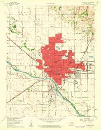
1960 · Hutchinson
USGS Topo · 1:24,000