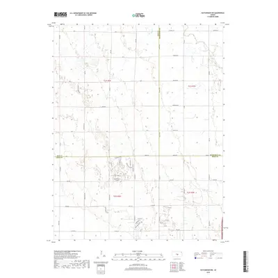
2018 Map of Hutchinson NW
USGS Topo · Published 2018About this map
The Little Arkansas River meanders across the northeast corner of this landscape, marking a distinct contrast to the grid-defined agricultural plains of Reno, Rice, and McPherson counties. This 2018 survey reveals a modern residential development pattern emerging in the southern portion of the quadrangle, characterized by thematic street naming such as Paganica Pass, Wovoka Dr, and Crazy Horse Rd. These winding residential corridors deviate sharply from the section-line roads like Pennington Rd and Ave Y that dominate the rest of the prairie. The geography is further defined by Sand Cr and a series of small, scattered wetlands, illustrating the subtle hydrology of the Kansas plains before the terrain reaches the more densely populated areas to the south and east.
Find a feature on this map
60 named features on this map. Tap any name to fly to it.
Don’t see what you’re looking for? This feature index may not catch every label — zoom into the map to look around manually.
Map Details
Editions of this 2018 Hutchinson NW Map
This is the sole edition of this map. No revisions or reprints were ever made.
Other maps of this area

1891 · Hutchinson
USGS Topo · 1:125,000

1893 · Hutchinson
USGS Topo · 1:125,000

1894 · Lyons
USGS Topo · 1:125,000

1955 · Great Bend
USGS Topo · 1:250,000

1955 · Hutchinson
USGS Topo · 1:250,000

1957 · Great Bend
USGS Topo · 1:250,000

1958 · Great Bend
USGS Topo · 1:250,000

1959 · Hutchinson
USGS Topo · 1:250,000

1960 · Yaggy
USGS Topo · 1:24,000
1960 · Hutchinson
USGS Topo · 1:24,000