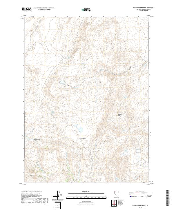
2021 Map of Idaho Canyon Spring
USGS Topo · Published 2021About this map
The Black Rock Range anchors this high-desert landscape in northern Humboldt County, where water sources dictate the geography of human activity and survival. Numerous seasonal and perennial springs are scattered across the terrain, including the whimsically named Santa Claus Spring in the north and Idaho Canyon Spring nestled between steep ridges. These water points, along with Tin Trough Spring and Dry Lake Springs, historically supported the cattle ranching and seasonal grazing common to this region, as evidenced by landmarks like Buck Pasture.
Find a feature on this map
31 named features on this map. Tap any name to fly to it.
Don’t see what you’re looking for? This feature index may not catch every label — zoom into the map to look around manually.
Map Details
Editions of this 2021 Idaho Canyon Spring Map
This is the sole edition of this map. No revisions or reprints were ever made.
Other maps of this area

1886 · Disaster
USGS Topo · 1:250,000

1889 · Long Valley
USGS Topo · 1:250,000

1893 · Disaster
USGS Topo · 1:250,000

1954 · Vya
USGS Topo · 1:250,000

1958 · Vya
USGS Topo · 1:250,000

1962 · Vya
USGS Topo · 1:250,000

1965 · Idaho Canyon
USGS Topo · 1:62,500

1965 · Rock Spring Table
USGS Topo · 1:62,500

1972 · Burnt Springs
USGS Topo · 1:24,000
1972 · Red Mountain
USGS Topo · 1:24,000