2022 Map of Idalou
USGS Topo · Published 2022About this map
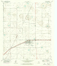
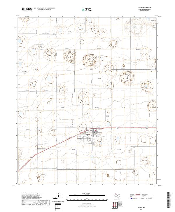
The city of Idalou serves as the focal point of this Lubbock County survey, situated at the intersection of a precise grid of county roads and highway corridors. The landscape is defined by its agricultural layout, where large sections are partitioned by routes like Co RD 5600 and N FM 1729. To the west, the settlement of Kitalou sits along the road network, while the Idalou Cem on the eastern edge provides a record of the community’s generational history. The presence of the Everitt Airport north of the main town center highlights the regional transportation infrastructure. A series of numbered and named avenues, including Vetch Ave and Ebony Ave, illustrates the methodical expansion of rural residency and farm-to-market access across this part of the Llano Estacado.
Find a feature on this map
74 named features on this map. Tap any name to fly to it.
Don’t see what you’re looking for? This feature index may not catch every label — zoom into the map to look around manually.
Map Details
Editions of this 2022 Idalou Map
This is the sole edition of this map. No revisions or reprints were ever made.