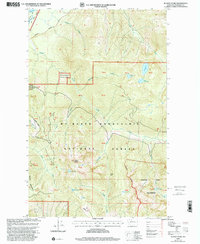
1999 Map of Illabot Peaks
USGS Topo · Published 2002About this map
Illabot Peaks and the high alpine terrain of the North Cascades define this landscape at the close of the twentieth century. The area is dominated by the Mt Baker - Snoqualmie National Forest and the Glacier Peak Wilderness, where drainage systems like Illabot Creek and Marten Creek carve through steep elevations. While the northwest corner shows the passage of the Skagit River and access via Cascade River Road and Rockport Road, the interior remains a roadless expanse of high-altitude basins. Localized features like Bettys Pass and Suiattle Mountain provide critical landmarks for navigating the jagged topography. Dozens of remote water bodies, including Lake Louise, Bee Lake, and Falls Lake, are scattered throughout the peaks, many only accessible by trail or cross-country travel through the Indefinite Boundary sections of the wilderness.
Find a feature on this map
42 named features on this map. Tap any name to fly to it.
Don’t see what you’re looking for? This feature index may not catch every label — zoom into the map to look around manually.
Map Details
Editions of this 1999 Illabot Peaks Map
This is the sole edition of this map. No revisions or reprints were ever made.
Other maps of this area

1899 · Glacier Peak
USGS Topo · 1:125,000

1899 · Stillaguamish
USGS Topo · 1:125,000

1901 · Glacier Peak
USGS Topo · 1:125,000

1901 · Stilaguamish
USGS Topo · 1:125,000

1909 · Mt Baker
USGS Topo · 1:192,000

1915 · Mt. Baker
USGS Topo · 1:250,000

1952 · Lake Shannon
USGS Topo · 1:62,500

1953 · Marblemount
USGS Topo · 1:62,500

1955 · Concrete
USGS Topo · 1:250,000

1958 · Concrete
USGS Topo · 1:250,000