Loading...
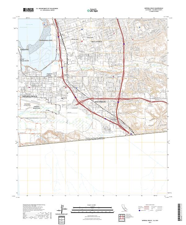
Loading map...2021 Map of Imperial Beach
USGS Topo · Published 2021About this map
The United States of America Estados Unidos Mexicanos border defines the southern extent of this 2021 survey, where the international line cuts across the coastal landscape of Border Field State Park. The region is a complex mix of military installations, dense residential neighborhoods, and protected wetlands. The Imperial Beach Naval Outlying Field occupies a significant portion of the southwestern corner, adjacent to the tidal reaches of the Tijuana River.
Find a feature on this map
46 named features on this map. Tap any name to fly to it.
Don’t see what you’re looking for? This feature index may not catch every label — zoom into the map to look around manually.
Map Details
Date Portrayed2021
Date Published2021
PublisherU.S. Geological Survey
Map TypeTopographic
Scale1:24000
Physical Dimensions24 x 29 inches
Editions of this 2021 Imperial Beach Map
This is the sole edition of this map. No revisions or reprints were ever made.
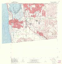
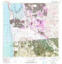
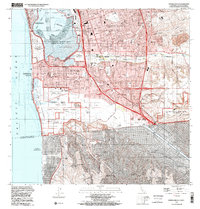
Historical Maps of South San Diego Through Time
4 maps found
Featured Locations
Source Details
SourceU.S. Geological Survey
CopyrightPublic Domain