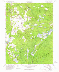
1957 Map of Indian Mills
USGS Topo · Published 1966About this map
Indian Mills Lake and the surrounding pine barrens topography define this 1957 landscape, characterized by an extensive network of commercial cranberry operations. The map reveals a specific regional economy through dozens of labeled Cranberry Bogs situated along Friendship Creek and the Batsto River. While settlements like Tabernacle and Indian Mills serve as focal points for local history, the presence of the Hampton Furnace site and the Carranza Memorial highlights the area's transition from early industrial activity to a landscape of memory and conservation.
Find a feature on this map
34 named features on this map. Tap any name to fly to it.
Don’t see what you’re looking for? This feature index may not catch every label — zoom into the map to look around manually.
Map Details
Editions of this 1957 Indian Mills Map
4 editions found
Other maps of this area

1888 · Pemberton
USGS Topo · 1:62,500

1888 · Mount Holly
USGS Topo · 1:62,500

1890 · Hammonton
USGS Topo · 1:62,500

1890 · Mullica
USGS Topo · 1:62,500

1894 · Hammonton
USGS Topo · 1:62,500

1894 · Pemberton
USGS Topo · 1:62,500

1894 · Mount Holly
USGS Topo · 1:62,500

1894 · Mullica
USGS Topo · 1:62,500

1898 · Pemberton
USGS Topo · 1:62,500

1898 · Mount Holly
USGS Topo · 1:62,500
Featured Places
- Southampton Township, NJ
- Tabernacle Township, NJ
- Shamong Township, NJ
- Meadford Farms, Tabernacle Township
- Oriental, Tabernacle Township